

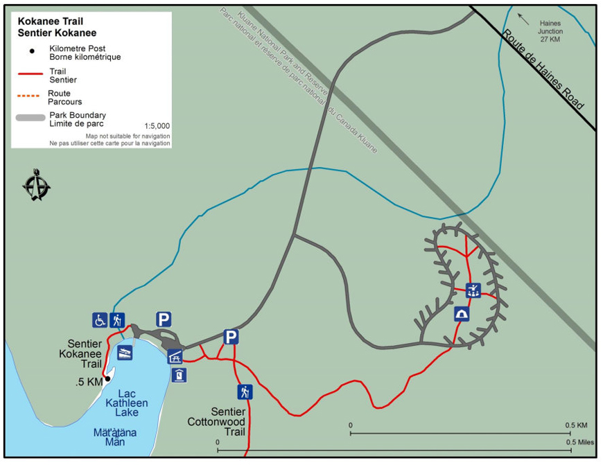
Kokanee Trail
Kluane National Park and Reserve
Distance: 1 km (0.6 mi) return
Time: 10-30 minutes
Elevation gain: 3 m (10’)
Maximum elevation: 735 m (2,411’)
Trailhead: 27 km (17 mi) south of Haines Junction on the Haines Road, turn into Kathleen Lake day-use area and park along the lake shore
Topo map: Kathleen Lakes 115 A/11
In summary
Wheel chair accessible boardwalk trail along the shore of Kathleen Lake.
Download the Kokanee Trail description (PDF, 356 Kb)The details
The trail begins at the far right hand side when facing the lake of the parking day use area. The trail follows the lake shore and has some interpretive signs providing information about the kokanee salmon that live in this lake. There are benches along the way to have a break or just enjoy the view. At the end of the boardwalk, you will see a narrow trail on your right that continues along the rocky lake shore.
Following along this trail offers up spectacular views of the lake and surrounding mountains.
What you need to know
Bear sightings are common in the area. Review recommendations for travel within the You Are In Bear Country brochure. All bear sightings should be reported to the staff at the Kluane National Park and Reserve Visitor Centre in Haines Junction or the Thachäl Dhäl Visitor Centre.
Parks Canada 24 hour emergency dispatch
1-780-852-3100
Cellular telephones do not work in most of the park. Satellite phones or satellite messaging devices are strongly recommended.
Related links
- Date modified :