
Hiking
Kluane National Park and Reserve
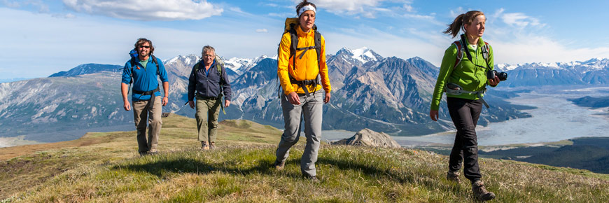
Hiking is Kluane's most popular activity. Opportunities range from short strolls to multi-day route-finding adventures. Whether you get out for an hour, a day, or a week, there is much to explore in Kluane.
Trailheads can be difficult to get to without a vehicle since there is no public transportation. Areas may be temporarily closed for safety or environmental reasons. Before your hike check:
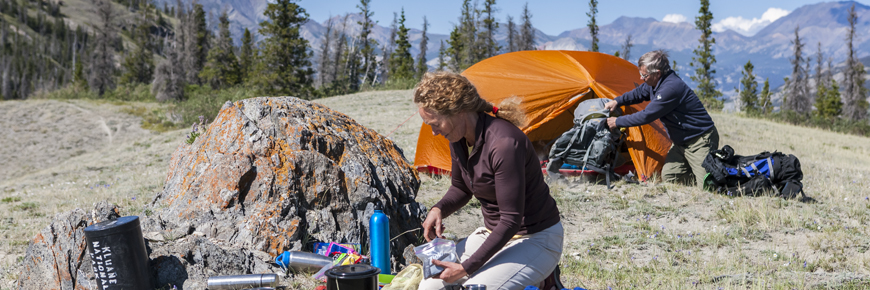
Overnight hikes
Backcountry permits/registration and de-registration is mandatory for all overnight use in Kluane National Park and Reserve between April 1 and November 15. The use of approved bear-resistant food canisters is mandatory.
Where to hike
Map of trails and routes
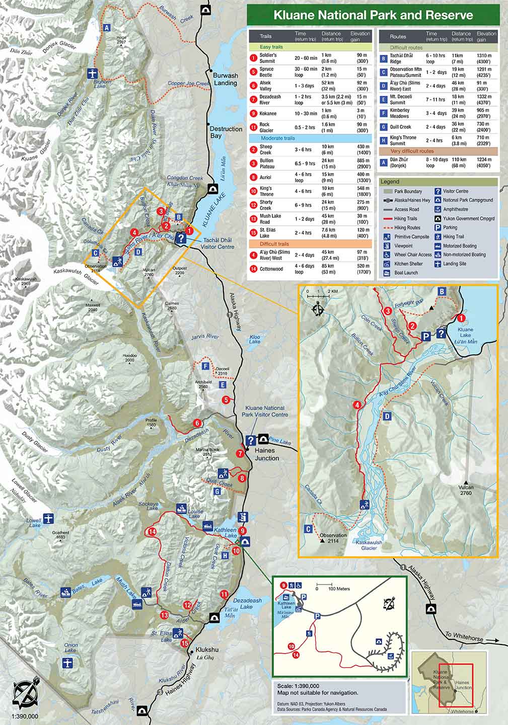
Trails
Trail
Map #
NameTime
(return)Distance
(return)Elevation
gainDescription
Easy trails
1
Soldier’s Summit20-60 min
1 km
(0.6 mi)90 m
(300')Self-guiding interpretive trail which leads to the site of the official opening of the Alaska Highway in 1942. Bicycles not permitted.
5
Spruce Beetle30-60 min
loop2 km
(1.2 mi)15 m
(50’)A well marked Yukon Government self-guiding interpretive trail. Some sections are boardwalk.
6
Alsek Valley1-3 days
52.8 km
(32.8 mi)92 m
(300')Follows an old mining road. The first 15 km may be drivable with 4-wheel drive/high clearance vehicles. Trail is in the valley bottom with some variable creeks to cross (no bridges).
7
Dezadeash River1-2 hrs
loop3.5 km (2.2 mi) or
5.5 km
(3 mi)15 m
(50')The first km is boardwalk and wood chip then joins an old trail from RV park. An observation platform and benches are situated along the trail.
9
Kokanee10-30 mins
1 km
(0.6 mi)3m
(10')A wheel chair accessible boardwalk skirting the shores of Kathleen Lake starting from the day use area. Bicycles not permitted.
11
Rock Glacier0.5-2 hrs
1.6 km
(1 mi)90 m
(300')A self-guiding interpretive trail. This short walk is an excellent way to see and learn about rock glaciers and get a view of Dezadeash Lake. Bicycles not permitted.
Moderate trails
2
Sheep Creek3-6 hrs
10 km
(6 mi)430 m
(1400’)This popular trail climbs up the side of Thechàl Dhâl (Sheep Mountain) above Sheep Creek offering excellent views of the Ä’äy Chù (Slims River) Valley. Bicycles not permitted. Camping not permitted.
3
Bullion Plateau6.5-9 hrs
24 km
(15 mi)885 m
(2900')A great but strenuous day hike for those wanting to experience the sub alpine and alpine areas in the north end of the park. Bicycles not permitted. Camping not permitted.
8
Auriol4-6 hrs
loop15 km
(9 mi)400 m
(1300')Starts in spruce and aspen forest and climbs up to the sub-alpine above Haines Junction. Some bridges over creeks. Primitive campground at top. Popular ski trail.
10
King's Throne4-6 hrs
10 km
(6 mi)548 m
(1800')A steep trail up to a spectacular glacial cirque - the "seat" of the King’s Throne. Alpine flowers and great views are among the highlights.Bicycles not permitted.
12
Shorty Creek6-9 hrs
22 km
(14 mi)275 m
(900')Follows old mining roads with some uphill sections before dipping down beside Shorty Creek. A perfect combo biking/hiking adventure.
13
Mush Lake Road1-2 days
52 km
(32 mi)30 m
(100')A four wheel drive road. Two-wheel drive vehicles with good clearance can drive the first 5 km to Alder Creek when conditions are good. Good mountain biking trail.
15
St. Elias Lake2-4 hrs
7.6 km
(4.8 mi)-120 m
(400')Old recreation road leading up to a small lake. A short day hike on easy terrain through a variety of habitats. Enjoyable for the whole family and a popular overnight trip.
Difficult trails
4
Ä’äy Chù (Slim’s River) West2-4
days45 km
(27.4 mi)97 m
(318’)Follows Ä’äy Chù (Slims River) west bank to Canada Creek and a primitive campground. From the campground, a route (i.e. there is no trail) heads up Observation Mountain. Bicycles not permitted.
14
Cottonwood4-6
days
loop85 km
(53 mi)520 m
(1700’) The longest trail in Kluane, it traverses two alpine passes. Start either at Kathleen Lake or the south end of Dezadeash Lake. Trailheads are 30 km apart by road.
Routes
A route is not a trail
Routes are not marked with signs or maintained in any manner. The routes described here are only suggestions that may help guide you on your trip. Self-reliance and wilderness travel experience are essential, including excellent route finding skills, map and compass skills. It is the responsibility of individual hikers who choose to follow such routes to adequately prepare and be prepared to rely on themselves.
Route
Map letter
NameTime
(return)Distance
(return)Elevation
gainDescription
Easy to moderate routes
Shepherd's Knoll (begins at Sheep Creek Trail)
20-90 minutes
1-2 km
(3.2-6.6 mi)61 m
(200’)This is an easy to moderate hike, perfect for the whole family. It takes you to the top of a little knoll, where you can enjoy the view over the Ä’äy Chù (Slims River) Valley, and where you can observe a diverse vegetation and the tracks left by Dall sheep on their frequent visits to the knoll. Bicycles not permitted. Camping not permitted.
Difficult routes
B
Thechàl Dhâl Ridge6-10 hrs
loop11 km
(7 mi)1300 m
(4300’)This is a long challenging day hike, which involves some steep off-trail travel. It offers spectacular panoramic vistas and excellent wildlife viewing opportunities. Bicycles not permitted.
C
Observation Mountain1-2 days
19 km
(12 mi)1920 m
(6299')Starting at Canada Creek primitive campground in the Ä’äy Chù (West) valley, route ascends Observation Mountain. Stunning views of the Kaskawulsh Glacier. A Kluane classic! Bicycles not permitted.
D
Ä’äy Chù (Slim’s River) East2-4 days
46 km
(28 mi)91 m
(299')This route skirts the eastern edge of the Ä’äy Chù (Slims River) providing access to mountain slopes which offer good views of the toe of the Kaskawulsh Glacier. Bicycles not permitted.
E
Mt. Decoeli7-11 hrs
18 km
(11 mi)1340 m
(4400')This rocky route climbs to a pass, then follows a steep ridge to the summit. Good views of the Icefield Ranges on a clear day, including Mt. Logan.
F
Kimberly Meadows3-4 days
38.8 km
(24 mi)1219 m
(4000')A rugged and challenging route that requires good route finding skills. There is opportunity to see wildlife along the route, spectacular wildflowers and rewarding views. Bicycles not permitted.
G
Quill Creek2-4 days
36 km
(22 mi)730 m
(2400')Not for the faint of heart! Takes you into the heart of the Auriol Range. Alpine meadows, spectacular scenery and wildlife viewing opportunities make it well worth the effort. Bicycles not permitted.
H
King's Throne Summit2-4 hrs
6 km
(3.8 mi)710 m
(2329')This route climbs from the "seat of the throne" to the peak of the mountain offering commanding views and abundant wildflowers. Bicycles not permitted.
Very difficult routes
A
Dän Zhùr (Donjek)8-10 days loop
96 km
(60 mi)2770 m
(9100’)One of the most popular hikes for wilderness enthusiasts. Rising over the vast alpine of the Burwash Uplands and then descending to the toe of the Donjek Glacier, this hike typifies "pristine mountain wilderness.” Bicycles not permitted.
Hiker safety
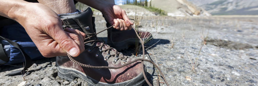
Kluane is a remote wilderness park. Hikers must be self-sufficient and able to handle emergency situations on their own. Plan ahead. Select a trip which suits your party and ensure that you are properly equipped for your trip.


- Date modified :