
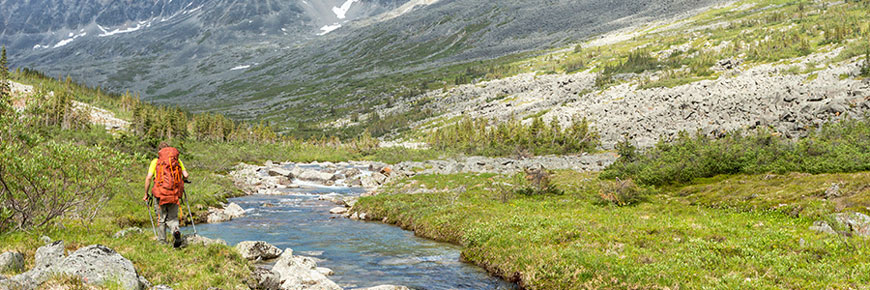
As one of Canada’s newest national parks, Nááts'įhch'oh has no established trails or routes. For experienced hikers, this means a rare opportunity to explore remote terrain and map routes that may one day become part of the park’s established trail network.
Start by chartering a float plane from nearby communities in the Northwest Territories or Yukon. Hikers can choose to set down at any number of Nááts'įhch'oh’s backcountry lakes, from the turquoise shoals of Nı́onep'eneɂ Tué (Grizzy Bear Lake) to Ǫtaa Tué Fehto (Divide Lake) and its maze of wetlands.
From there, chart your own route into the largely unexplored heartlands of Nááts'įhch'oh. Follow meandering rivers through lush wetlands dotted with stunted evergreens, climb the rocky flanks of the Mackenzie Mountains and look out for alpine wildlife ranging from the mountain woodland caribou to trumpeter swans, grizzlies and mountain goats.
| Nááts'įhch'oh Trip Planner Hiking 2017 |
Nááts'įhch'oh Reiseplaner Wandern 2017 |
||
|---|---|---|---|
 |
 |
||
|
Nááts'įhch'oh Visitor Guide Hiking - 2017.PDF 3.94 MB PDF |
Reiseplaner - Wandern - 2017.pdf |
Related links
- Date modified :