
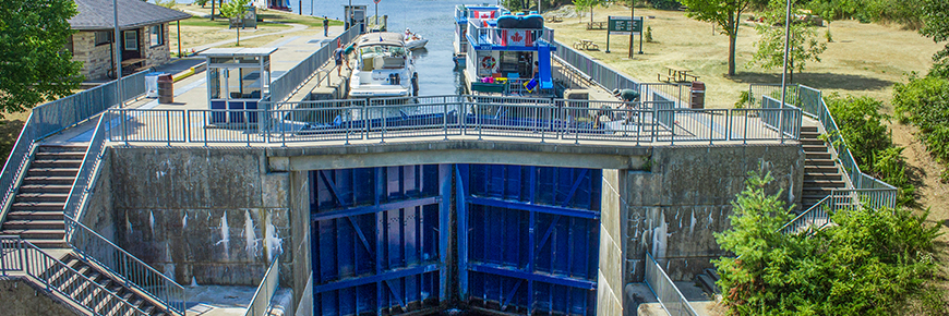
Lock 28 - Burleigh Falls
Trent-Severn Waterway National Historic Site
The entrance to Lock 28 is hidden when boating up Stony Lake from Young's Point, therefore reduce speed and watch for discharge from the dam. Lock 28 offers a great boat launch.
Getting here
- Address: 4834 Highway 28, Concession 1, Lot 5, Burleigh Falls, Ontario
- Nautical chart: #2023 (more on Nautical charts)
- Kilometer marker: 181.8 km (mile 113)
- GPS: 44°33'36.3"N 78°12'28.6"W
Hours of Operation
Contact:
- Phone number: (705) 654 - 3538
- Email address: trentsevern@pc.gc.ca
Navigational data
- Lock length: 37.8 m (124 ft)
- Lock width: 9.7 m (32 ft)
- Average lift: 7.3 m (24 ft)
- Max. mooring period: 2 nights
Facilities and services
- Overnight mooring
- Camping
- Paddle dock
- Washrooms
- Potable water
- Picnic area
- Firewood ($)
- Ice ($)
- Visitor information
History
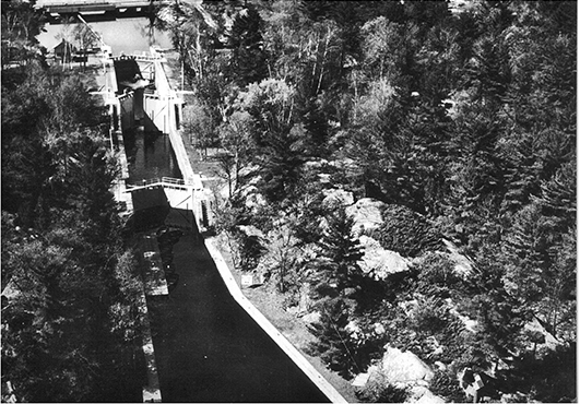
Constructed: 1882-1887
Burleigh Falls was used in the 1800s for log drives during the spring melt. In 1882 the contract for a flight lock was awarded to George Goodwin. Wooden dams, later rebuilt in concrete, raised water levels but flooded out islands upstream. The flight lock was replaced with a single concrete lock in 1967 eliminating the number 29 from the system.
Tourism information
- Peterborough and the Kawarthas Tourism
Phone number: (705) 742-2201 or 1-800-461-6424
- Kawarthas Northumberland
Google Street View
Related links
- Lock 1 - Trenton
- Lock 2 - Sydney
- Lock 3 - Glen Miller
- Lock 4 - Batawa
- Lock 5 - Trent
- Lock 6 - Frankford
- Lock 7 - Glen Ross
- Lock 8 - Percy Reach
- Lock 9 - Meyers
- Lock 10 - Hagues Reach
- Lock 11-12 - Ranney Falls
- Lock 13 - Campbellford
- Lock 14 - Crowe Bay
- Lock 15 - Healey Falls
- Lock 16 / 17 - Healey Falls Flight Lock
- Lock 18 - Hastings
- Lock 19 - Scotts Mills
- Lock 20 - Ashburnham
- Lock 21 - Peterborough Lift Lock
- Lock 22 - Nassau Mills
- Lock 23 - Otonabee
- Lock 24 - Douro
- Lock 25 - Sawer Creek
- Lock 26 - Lakefield
- Lock 27 - Young's Point
- Lock 30 - Lovesick
- Lock 31 - Buckhorn
- Lock 32 - Bobcaygeon
- Lock 33 - Lindsay
- Lock 34 - Fenelon Falls
- Lock 35 - Rosedale
- Lock 36 - Kirkfield
- Lock 37 - Bolsover
- Lock 38 - Talbot
- Lock 39 - Portage
- Lock 40 - Thorah
- Lock 41 - Gamebridge
- Lock 42 - Couchiching
- Lock 43 - Swift Rapids
- Lock 44 - Big Chute Marine Railway
- Lock 45 - Port Severn
- Date modified :